Case Study — Healthcare Analytics
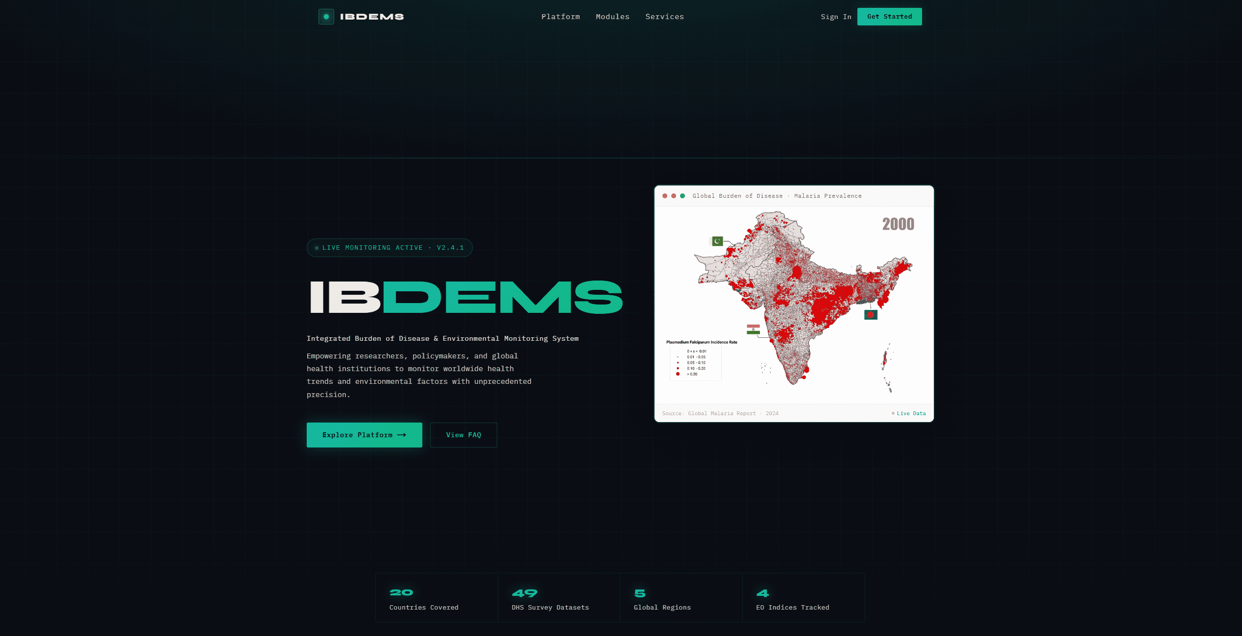
IBDEM System — Global Burden
of Disease & Environmental Intelligence
A research platform for epidemiologists and policymakers that correlates 49 Demographic Health Survey datasets with satellite-derived Earth Observation indices — enabling interactive analysis of how environmental factors drive disease burden across 20 countries.
System Architecture
Overview
Bridging the Global Burden of Disease Data Gap
The Global Burden of Disease (GBD) has no single surveillance, census, or survey dataset that covers all contributing factors. Environmental variables — vegetation index, rainfall patterns, air quality, and proximity to water bodies — are key predictors of disease incidence, but had never been systematically integrated with DHS health survey data at this scale. IBDEM was designed to fill that gap.
The Problem
Fragmented Disease Intelligence
- No unified dataset links environmental factors to GBD metrics
- DHS survey data is rich but disconnected from satellite EO data
- Existing tools are hardware-heavy or require high computational access
- Researchers lack interactive visualization for cross-country disease comparison
- Environmental-disease correlations remain theoretical without scalable tooling
The Solution
Integrated EO + Survey Analytics
IBDEM integrates 49 DHS survey datasets across 20 countries with four satellite-derived Earth Observation indices from Google Earth Engine — NDVI, rainfall, nightlight intensity, and water body proximity — providing researchers with interactive dashboards to explore disease-environment relationships across 5 global regions.
Key Features
Research-Grade Analytics at Scale
Data Sources
Built on Peer-Reviewed Global Health Data
The DHS Program (USAID-funded) is the gold standard for health survey data in low- and middle-income countries — used in studies published in Nature, The Lancet, PNAS, and NeurIPS. IBDEM accessed this data under formal request, integrating it with freely available Sentinel-2 and Landsat satellite imagery processed through Google Earth Engine.
Health Survey Data
DHS Program (USAID)
49 nationally representative surveys covering fertility, family planning, maternal health, child mortality, malaria, anemia, HIV/AIDS, and infectious diseases. Formal access request approved; data usage validated against published literature.
Satellite EO Data
Google Earth Engine
4 indices derived from Sentinel-2 and MODIS imagery: NDVI (vegetation stress), rainfall anomalies (CHIRPS), nighttime light intensity (VIIRS), and distance to water bodies — all processed at 10–250m resolution.
Technology Stack
Geospatial Stack for Epidemiological Research
Context
Advancing Global Health Research Infrastructure
While the DHS Program is extensively cited in published literature (NeurIPS, arXiv, ScienceDirect, The Lancet), no scalable platform existed to cross-reference DHS data with real-time satellite environmental indicators for GBD analysis. IBDEM addresses that gap directly.
Built By
Development Team

Hafiz Muhammad Abu Bakar
DeveloperAbdullah Riaz
Developer
Mujadid Sana
DeveloperNeed a data platform for health or environmental research?
We build research analytics platforms, geospatial dashboards, and satellite data pipelines for healthcare, public health, and environmental science organizations.